2008
SO9063 : Weir on the Salwarpe
taken 16 years ago, near to Droitwich Spa, Worcestershire, England
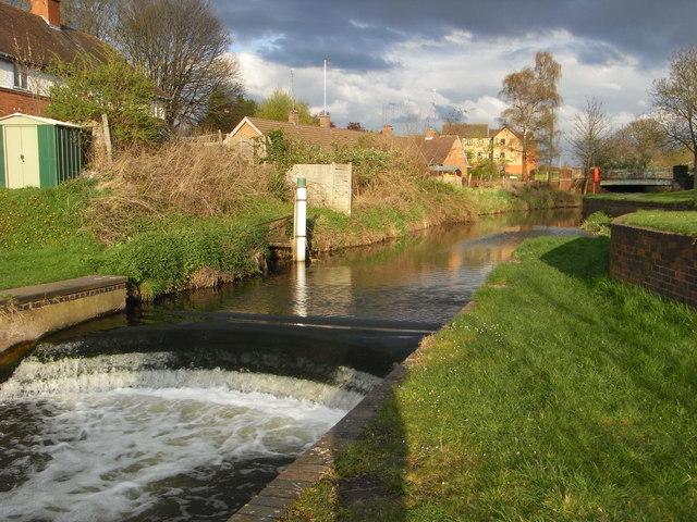
Weir on the Salwarpe
This relatively modern weir keeps up the level of water in the Droitwich Barge Canal. This commences off to the right. The bridge in the background takes the B4090 (former A38) over the River Salwarpe.
 Map © Crown Copyright")
TIP: Click the map for more Large scale mapping
- Grid Square
- SO9063, 506 images (more nearby 🔍)
- Photographer
- Chris Allen (more nearby)
- Date Taken
- Sunday, 13 April, 2008 (more nearby)
- Submitted
- Sunday, 13 April, 2008
- Subject Location
-
OSGB36:
 SO 901 635 [100m precision]
WGS84: 52:16.1740N 2:8.7459W - Camera Location
-
OSGB36: SO 901 635
- View Direction
- East-southeast (about 112 degrees)