2008
SY8082 : Downland scenery
taken 16 years ago, near to Chaldon Herring or East Chaldon, Dorset, England
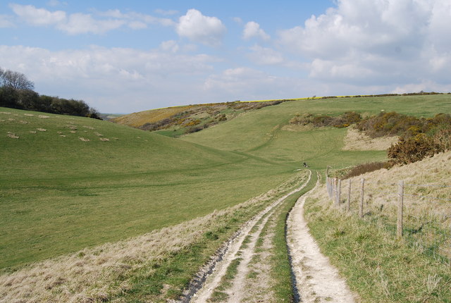
Downland scenery
A classic example of a chalk dry valley.
Dry Valley (Chalk)
Dry valleys are relict landforms left over from the ice age. During the ice age, ice plugged all the pore spaces in the chalk rendering it impermeable. During the summer months meltwater would carve a valley and create the feature. After the ice age the chalk became permeable and porous and all surface water was lost leaving an obvious water carved valley, but now dry.
They are common on the dip slopes of Chalk escarpments.
 Map © Crown Copyright")
TIP: Click the map for more Large scale mapping
- Grid Square
- SY8082, 9 images (more nearby 🔍)
- Photographer
- N Chadwick (more nearby)
- Date Taken
- Wednesday, 9 April, 2008 (more nearby)
- Submitted
- Monday, 14 April, 2008
- Subject Location
-
OSGB36:
 SY 804 822 [100m precision]
WGS84: 50:38.3927N 2:16.6613W - Camera Location
-
OSGB36: SY 805 820
- View Direction
- North-northwest (about 337 degrees)