2008
TA1536 : Oubrough Lane
taken 16 years ago, near to Coniston, East Riding of Yorkshire, England
This is 1 of 2 images, with title starting with Oubrough in this square
Oubrough Lane
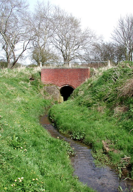
Drain under the old course of Oubrough Lane west of Ellerby. Oubrough Lane and the rest of the A165 has been straightened over the years leaving a number of lay-bys.
 Map © Crown Copyright")
TIP: Click the map for more Large scale mapping
- Grid Square
- TA1536, 18 images (more nearby 🔍)
- Photographer
- Paul Glazzard (more nearby)
- Date Taken
- Monday, 21 April, 2008 (more nearby)
- Submitted
- Thursday, 24 April, 2008
- Subject Location
-
OSGB36:
 TA 155 368 [100m precision]
WGS84: 53:48.8798N 0:14.8325W - Camera Location
-
OSGB36: TA 155 368
- View Direction
- East-northeast (about 67 degrees)