2008
TA0387 : Falsgrave Road and the Snicket
taken 16 years ago, near to Scarborough, North Yorkshire, England
This is 1 of 9 images, with title starting with Falsgrave Road in this square
Falsgrave Road and the Snicket
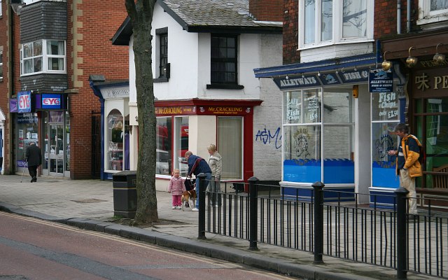
This photograph shows a number of shop fronts on the southern side of TA0388 : Falsgrave Road. This road is a small shopping area with most of the shops occupied and trading.
Between the red painted shop and the blue Fish and Chip bar is and entrance to an alleyway, which, in the 1950s and 1960s was known locally as TA0387 : The Snicket. At that time the Fish and Chip shop had its entrance inside 'The Snicket.
These shops are between TA0387 : New Park Road to the right (westerly) and All Saints Road to the left (easterly). The photograph was taken from the pedestrian reservation on Falsgrave Road near The Commercial public house and the junction with TA0388 : Commercial Street.
Road name information from OS Maps.
 Map © Crown Copyright")
TIP: Click the map for more Large scale mapping
- Grid Square
- TA0387, 303 images (more nearby 🔍)
- Photographer
- Alan Walker (more nearby)
- Date Taken
- Wednesday, 9 April, 2008 (more nearby)
- Submitted
- Monday, 5 May, 2008
- Subject Location
-
OSGB36:
 TA 035 879 [100m precision]
WGS84: 54:16.6198N 0:24.7173W - Camera Location
-
OSGB36: TA 034 879
- View Direction
- EAST (about 90 degrees)