2005
NU1023 : Cateran's Hole
taken 19 years ago, 3 km from Harehope, Northumberland, England
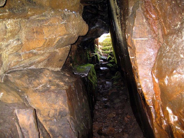
Cateran's Hole
This tunnel cave is in the middle of an isolated moor. The cave extends for a very long distance under the moor. Locals say it runs from Hepburn to Chillingham Castle
 Map © Crown Copyright")
TIP: Click the map for more Large scale mapping
- Grid Square
- NU1023, 17 images (more nearby 🔍)
- Photographer
- J C Ousby (more nearby)
- Date Taken
- Saturday, 7 May, 2005 (more nearby)
- Submitted
- Tuesday, 15 November, 2005
- Subject Location
-
OSGB36:
 NU 103 233 [100m precision]
WGS84: 55:30.2023N 1:50.3098W