2005
SE7226 : Asselby Island and confluence of Rivers Aire and Ouse
taken 18 years ago, near to Airmyn, East Riding of Yorkshire, England
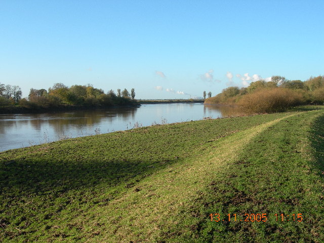
Asselby Island and confluence of Rivers Aire and Ouse
This picture shows the confluence of the rivers Aire and Ouse. Asselby island (to the right) is only an island on a very high tide - however the main channel of the Ouse has changed course in the past century - in the early part of the last century, the channel was at the other side of the island.
The power station visible in the background is Eggborough - the plume from Drax is visible emerging over Asselby island in the right of the photo.
The power station visible in the background is Eggborough - the plume from Drax is visible emerging over Asselby island in the right of the photo.
 Map © Crown Copyright")
TIP: Click the map for more Large scale mapping
- Grid Square
- SE7226, 36 images (more nearby 🔍)
- Photographer
- Simon Rance (more nearby)
- Date Taken
- Sunday, 13 November, 2005 (more nearby)
- Submitted
- Tuesday, 15 November, 2005
- Subject Location
-
OSGB36:
 SE 72 26 [1000m precision]
WGS84: 53:43.7920N 0:54.1536W - Camera Location
-
OSGB36: SE 727 263