2008
NU2410 : The Aln Estuary
taken 16 years ago, near to Alnmouth, Northumberland, England
This is 1 of 6 images, with title The Aln Estuary in this square
The Aln Estuary
NU2410 : The Aln Estuary : previous (image 8 of 8 ) first : NU2311 : The Aln Estuary
(A short walk along the B1338 between Hipsburn and Alnmouth)
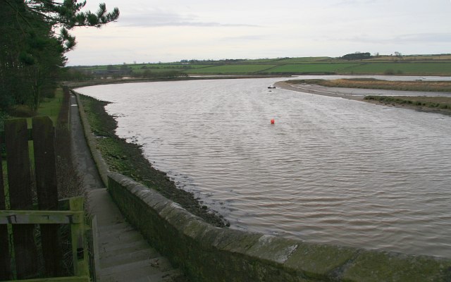
The photograph was taken from the eastern end of a road-bridge carrying the B1338 into the western side of Alnmouth.
The footpath (ahead) follows the River Aln into the southern part of the town.
(A short walk along the B1338 between Hipsburn and Alnmouth)
The photograph was taken from the eastern end of a road-bridge carrying the B1338 into the western side of Alnmouth.
The footpath (ahead) follows the River Aln into the southern part of the town.
 Map © Crown Copyright")
TIP: Click the map for more Large scale mapping
- Grid Square
- NU2410, 438 images (more nearby 🔍)
- Photographer
- Alan Walker (more nearby)
- Date Taken
- Saturday, 2 February, 2008 (more nearby)
- Submitted
- Wednesday, 14 May, 2008
- Subject Location
-
OSGB36:
 NU 243 107 [100m precision]
WGS84: 55:23.4012N 1:37.0206W - Camera Location
-
OSGB36: NU 243 108
- View Direction
- SOUTH (about 180 degrees)