2008
TQ0647 : Chantry Lane Ford
taken 16 years ago, near to Shere, Surrey, England
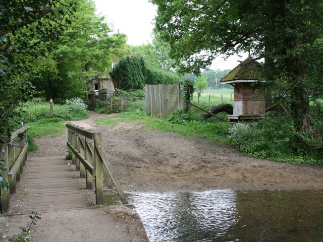
Chantry Lane Ford
The ford lies at the bottom of Chantry Lane (D225): Dark Lane (bridleway Shere 151) to Shere Heath continues ahead to the left of Dark Lane Cottage, to the right of the cottage, a gate gives access to footpath Shere 148 across Albury Park to Park Road, and a footpath (also Shere 148) leads left from the opposite side of the footbridge into the village of Shere (and affords this view of TQ0647 : Chantry Bridge). On the other side and to the right of the ford is what appears to be a rustic shelter... TQ0647 : What lies within.
 Map © Crown Copyright")
TIP: Click the map for more Large scale mapping
- Grid Square
- TQ0647, 194 images (more nearby 🔍)
- Photographer
- Hugh Craddock (more nearby)
- Date Taken
- Saturday, 17 May, 2008 (more nearby)
- Submitted
- Saturday, 17 May, 2008
- Subject Location
-
OSGB36:
 TQ 0691 4764 [10m precision]
WGS84: 51:13.0776N 0:28.2366W - Camera Location
-
OSGB36: TQ 0690 4767
- View Direction
- South-southeast (about 157 degrees)