2008
SO2759 : Herrock Hill
taken 16 years ago, near to Knill, County of Herefordshire, England
This is 1 of 5 images, with title Herrock Hill in this square
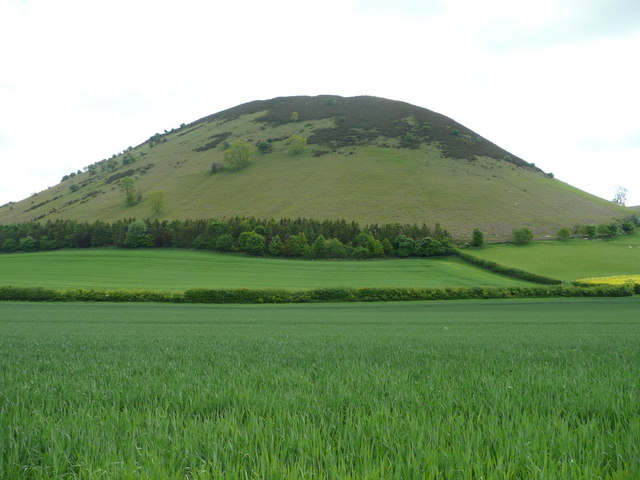
Herrock Hill
An almost-perfect dome just within Herefordshire viewed from the Dunfield to Lower Harpton lane.
 Map © Crown Copyright")
TIP: Click the map for more Large scale mapping
- Grid Square
- SO2759, 20 images (more nearby 🔍)
- Photographer
- Jonathan Billinger (more nearby)
- Date Taken
- Tuesday, 20 May, 2008 (more nearby)
- Submitted
- Tuesday, 20 May, 2008
- Subject Location
-
OSGB36:
 SO 278 595 [100m precision]
WGS84: 52:13.7746N 3:3.5113W - Camera Location
-
OSGB36: SO 272 595
- View Direction
- EAST (about 90 degrees)