1970
NG8634 : Strome Ferry
taken 54 years ago, near to Stromeferry, Highland, Scotland
This is 1 of 4 images, with title Strome Ferry in this square
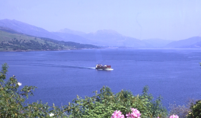
Strome Ferry
This is a historic shot of the car ferry which was the only way to get across Loch Carron until the new road was opened round the loch in 1971.
 Map © Crown Copyright")
TIP: Click the map for more Large scale mapping
- Grid Square
- NG8634, 93 images (more nearby 🔍)
- Photographer
- Anne Burgess (more nearby)
- Date Taken
- June 1970 (more nearby)
- Submitted
- Monday, 9 May, 2005
- Subject Location
-
OSGB36:
 NG 864 349 [100m precision]
WGS84: 57:21.2675N 5:33.1191W - Camera Location
-
OSGB36: NG 862 346
- View Direction
- Northeast (about 45 degrees)