2008
SJ5241 : Whitchurch - Llangollen Canal north of Danson's Bridge
taken 16 years ago, near to Grindley Brook, Shropshire, England
This is 1 of 8 images, with title starting with Whitchurch in this square
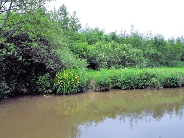
Whitchurch - Llangollen Canal north of Danson's Bridge
Whitchurch - Llangollen Canal north of Danson's Bridge. Towpath forms the Sandstone Trail and the Marches Way. Yellow Flags and lush vegetation beside the canal. It looks as if the land across the canal is being planted as new woodland.
 Map © Crown Copyright")
TIP: Click the map for more Large scale mapping
- Grid Square
- SJ5241, 101 images (more nearby 🔍)
- Photographer
- Mike Harris (more nearby)
- Date Taken
- Sunday, 1 June, 2008 (more nearby)
- Submitted
- Saturday, 7 June, 2008
- Subject Location
-
OSGB36:
 SJ 5223 4199 [10m precision]
WGS84: 52:58.3874N 2:42.7682W - Camera Location
-
OSGB36: SJ 5223 4199
- View Direction
- East-northeast (about 67 degrees)