2008
SX8771 : Footbridge over mouth of Aller Brook
taken 16 years ago, near to Kingsteignton, Devon, England
This is 1 of 2 images, with title Footbridge over mouth of Aller Brook in this square
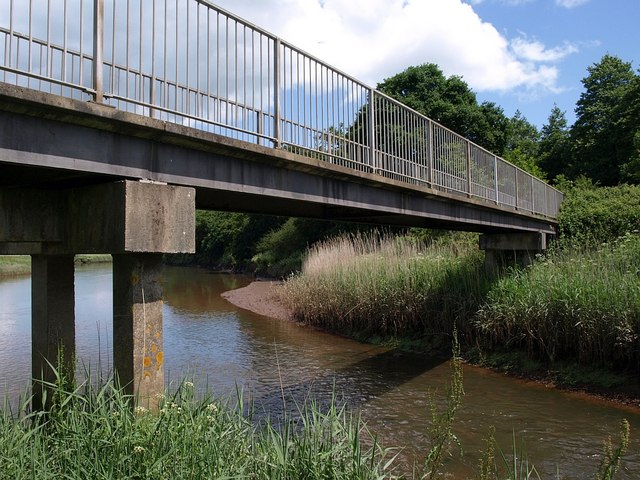
Footbridge over mouth of Aller Brook
The Aller Brook meets the River Teign just after flowing under the bridge, which carries the Templer Way, here following Newton Abbot Footpath 32. Both watercourse are tidal here.
 Map © Crown Copyright")
TIP: Click the map for more Large scale mapping
- Grid Square
- SX8771, 241 images (more nearby 🔍)
- Photographer
- Derek Harper (more nearby)
- Date Taken
- Thursday, 5 June, 2008 (more nearby)
- Submitted
- Saturday, 7 June, 2008
- Subject Location
-
OSGB36:
 SX 8741 7169 [10m precision]
WGS84: 50:32.0469N 3:35.4021W - Camera Location
-
OSGB36: SX 8740 7169
- View Direction
- East-northeast (about 67 degrees)