2005
SK2554 : Old Windmill near to Carsington Pastures
taken 19 years ago, near to Carsington, Derbyshire, England
This is 1 of 3 images, with title starting with Old in this square
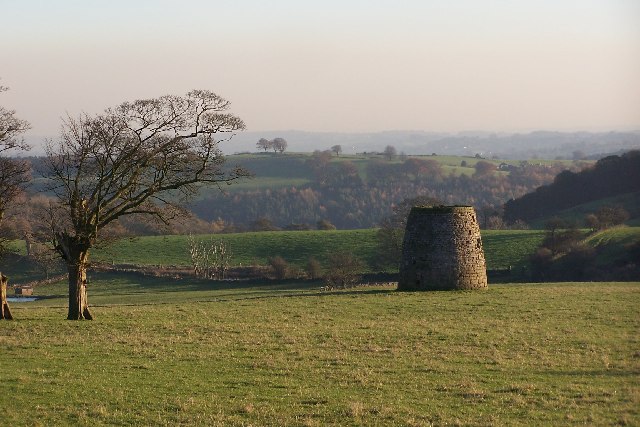
Old Windmill near to Carsington Pastures
Looking south east towards Wirksworth from the High Peak Trail at Hopton Incline. I always thought that this was a lime kiln but the map says it's an old windmill and was probably used as part of the ore processing procedures from nearby lead mines.
 Map © Crown Copyright")
TIP: Click the map for more Large scale mapping
- Grid Square
- SK2554, 64 images (more nearby 🔍)
- Photographer
- Phil Berry (more nearby)
- Date Taken
- Tuesday, 18 October, 2005 (more nearby)
- Submitted
- Friday, 25 November, 2005
- Subject Location
-
OSGB36:
 SK 25 54 [1000m precision]
WGS84: 53:5.2267N 1:37.2435W - Camera Location
-
OSGB36: SK 253 546