2005
TL2212 : Lemsford Village
taken 18 years ago, near to Stanborough, Hertfordshire, England
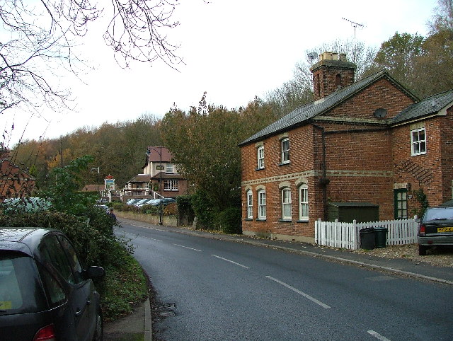
Lemsford Village.
To the left, and not possible to get a view of at this point is the River Lea. This photograph is taken from the Welwyn Garden City - Lemsford road. The pub in the distance is the "Long Arm and the Short Arm". The pub sign depicts a wooden lever arm that indicated the depth of the water at the crossing point of the River Lea of the ancient Great North Road. When the arm was in the dropped or raised position it showed the depth of water to the horse drawn waggoners and other users.
 Map © Crown Copyright")
TIP: Click the map for more Large scale mapping
- Grid Square
- TL2212, 38 images (more nearby 🔍)
- Photographer
- Robin Hall (more nearby)
- Date Taken
- Monday, 28 November, 2005 (more nearby)
- Submitted
- Monday, 28 November, 2005
- Subject Location
-
OSGB36:
 TL 221 124 [100m precision]
WGS84: 51:47.8157N 0:13.8490W - Camera Location
-
OSGB36: TL 222 123
- View Direction
- Northwest (about 315 degrees)