2005
SK0981 : Mining remains, Rushup Farm
taken 18 years ago, near to Sparrowpit, Derbyshire, England
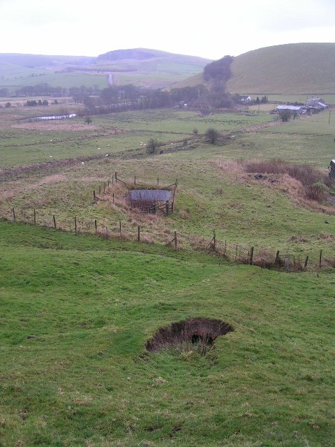
Mining remains, Rushup Farm
In the foreground is a collapsed brick flue, and behind that (covered by a square grille and enclosed within a fence) a disused mineshaft. On Gautries Hill behind the position of a "rake" (a line of lead mines along a vein of ore) is indicated by the line of trees. Eldon Hill Quarry is in the distance to the left of this picture.
 Map © Crown Copyright")
TIP: Click the map for more Large scale mapping
- Grid Square
- SK0981, 35 images (more nearby 🔍)
- Photographer
- Dave Dunford (more nearby)
- Date Taken
- Sunday, 4 December, 2005 (more nearby)
- Submitted
- Sunday, 4 December, 2005
- Subject Location
-
OSGB36:
 SK 091 812 [100m precision]
WGS84: 53:19.6585N 1:51.8899W