2008
TQ5946 : Town Mill, Tonbridge
taken 16 years ago, near to Tonbridge, Kent, England
This is 1 of 2 images, with title starting with Town Mill in this square
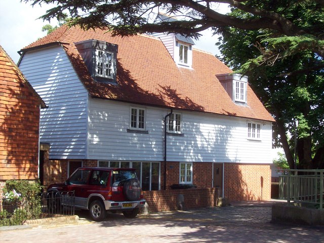
Town Mill, Tonbridge
The new house built on the surviving lower walls of Town Mill, Tonbridge.
 Map © Crown Copyright")
TIP: Click the map for more Large scale mapping
- Grid Square
- TQ5946, 1625 images (more nearby 🔍)
- Photographer
- Michael Roots (more nearby)
- Date Taken
- Sunday, 13 July, 2008 (more nearby)
- Submitted
- Saturday, 19 July, 2008
- Subject Location
-
OSGB36:
 TQ 595 467 [100m precision]
WGS84: 51:11.8667N 0:16.9479E - Camera Location
-
OSGB36: TQ 595 467
- View Direction
- EAST (about 90 degrees)