2004
NS9780 : Kerse Mains
taken 20 years ago, 3 km from Bo'ness, Falkirk, Scotland
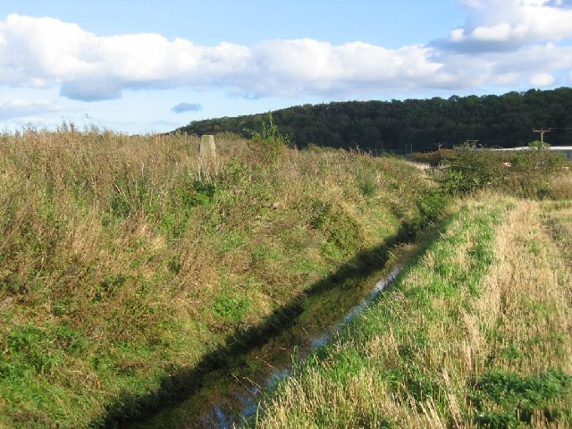
Kerse Mains
The ditch is roughly the site of the old shoreline. Landfill tipping has reclaimed a lot of land from coastal mudflats here, and today the Forth is over a km distant.
 Map © Crown Copyright")
TIP: Click the map for more Large scale mapping
- Grid Square
- NS9780, 45 images (more nearby 🔍)
- Photographer
- Richard Webb (more nearby)
- Date Taken
- Friday, 8 October, 2004 (more nearby)
- Submitted
- Wednesday, 11 May, 2005
- Subject Location
-
OSGB36:
 NS 972 805 [100m precision]
WGS84: 56:0.4207N 3:38.9928W - Camera Location
-
OSGB36: NS 971 805
- View Direction
- East-northeast (about 67 degrees)