2008
NX9489 : Dalswinton Wind Farm
taken 16 years ago, 4 km W of Ae, Dumfries And Galloway, Scotland
This is 1 of 2 images, with title Dalswinton Wind Farm in this square
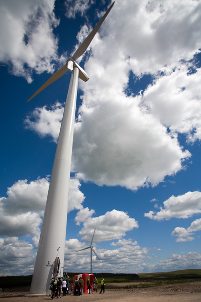
Dalswinton Wind Farm
Two of the 15 wind turbines at the Dalswinton wind farm, 80m high to hub height, 121m to blade tip. Photograph taken during the open day organised by the operators Airtricity.
 Map © Crown Copyright")
TIP: Click the map for more Large scale mapping
- Grid Square
- NX9489, 3 images (more nearby 🔍)
- Photographer
- Roy Tait (more nearby)
- Date Taken
- Saturday, 14 June, 2008 (more nearby)
- Submitted
- Sunday, 20 July, 2008
- Subject Location
-
OSGB36:
 NX 946 893 [100m precision]
WGS84: 55:11.2350N 3:39.3997W - Camera Location
-
OSGB36: NX 945 894
- View Direction
- Southeast (about 135 degrees)