2005
SS5144 : Higher or Lower Mullacott?
taken 18 years ago, near to Slade, Devon, England
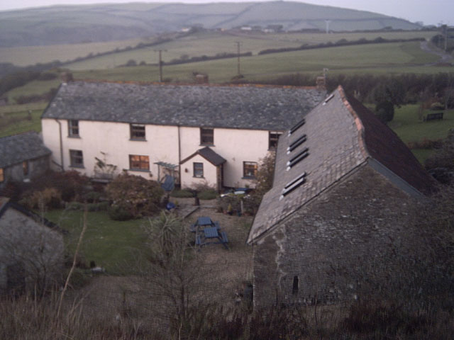
Higher or Lower Mullacott?
Taken from the stile near the A361. The OS map says that this is Higher Mullacott. A sign nearby said Lower Mullacott, but that could have been an access road to the other farm. I'll try to resolve this.
 Map © Crown Copyright")
TIP: Click the map for more Large scale mapping
- Grid Square
- SS5144, 20 images (more nearby 🔍)
- Photographer
- Grant Sherman (more nearby)
- Date Taken
- Saturday, 10 December, 2005 (more nearby)
- Submitted
- Sunday, 11 December, 2005
- Subject Location
-
OSGB36:
 SS 51 44 [1000m precision]
WGS84: 51:10.8236N 4:7.5583W