NS3976 : River Leven footpath
taken 17 years ago, near to Renton, West Dunbartonshire, Scotland
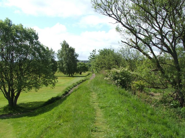
This description covers a subset of West Dumbartonshire's core paths (4953 inclusive and 157) that, when taken together, make up a continuous path (49 + 50 + 52 + 53) along or near the eastern bank of the River Leven ( Link ), beginning at the Lion's Gate at Kilmalid, and ending at Dumbarton Rock(*). Two shorter paths (51 and 157) branch off from the riverside path. Others paths branch off from it near the SUDS pond at Lomondgate ( Link ); these are also included here, although they are not core paths.
(*) Note that, as of mid-2018, core path 53 stops at the east end of Riverside Lane, but it is intended that it eventually be extended to become a riverside walkway to Dumbarton Rock.
See Link(PDF, 1.3MB, at the West Dunbartonshire Council website) for a visual index to all of these paths. Summary descriptions (where "BMIE" = Broadmeadow Industrial Estate and "CP" = Core Path):
CP 49 (741m): Beside the Murroch Burn; from the Lion's Gate to the Blue Bridge.
CP 50 (1019m): Heads south (beside a golf course) from the Blue Bridge to NW corner of BMIE.
CP 51 (440m): Branches off eastwards from CP 50; leads to Overburn Avenue.
CP 52 (849m): Heads south from NW corner of BMIE to Dumbarton Bridge.
CP 157 (84m): A short path branching off east from CP 52; leads to Poplar Road.
CP 53 (476m+): From Dumbarton Bridge to Riverside Lane (and, later, to Dumbarton Rock).
 Map © Crown Copyright")
- Grid Square
- NS3976, 200 images (more nearby 🔍)
- Photographer
- Lairich Rig (more nearby)
- Date Taken
- Friday, 25 May, 2007 (more nearby)
- Submitted
- Saturday, 26 July, 2008
- Subject Location
-
OSGB36:
 NS 392 764 [100m precision]
WGS84: 55:57.2467N 4:34.5351W - Camera Location
-
OSGB36: NS 394 766
- View Direction
- Southwest (about 225 degrees)