2005
SK0679 : Footpath from Martinside
taken 18 years ago, near to Chapel-en-le-Frith, Derbyshire, England
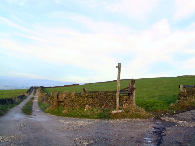
Footpath from Martinside
At the summit of Long Lane, just west of Martinside, this footpath descends into Chapel en le Frith via Eaves Hall after crossing the railway. The stone step stiles in the walls are superfluous now that the gate has vanished.
 Map © Crown Copyright")
TIP: Click the map for more Large scale mapping
- Grid Square
- SK0679, 13 images (more nearby 🔍)
- Photographer
- Roger May (more nearby)
- Date Taken
- Sunday, 11 December, 2005 (more nearby)
- Submitted
- Sunday, 11 December, 2005
- Subject Location
-
OSGB36:
 SK 064 794 [100m precision]
WGS84: 53:18.6900N 1:54.3244W