2008
SW4333 : Fields
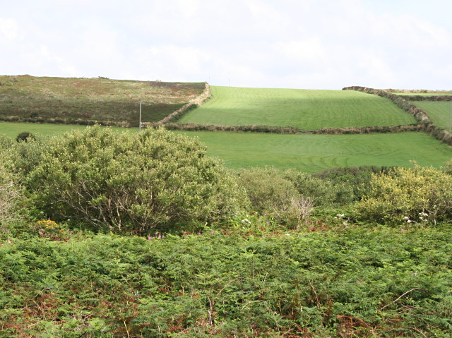
taken 16 years ago, near to Boskednan, Cornwall, England
Fields
Beyond the valley-bottom scrub the fields on the hillside are used for growing grass for silage to feed dairy herds. The field on the left has gone out of cultivation and is reverting to heathland vegetation.
 Map © Crown Copyright")
TIP: Click the map for more Large scale mapping
- Grid Square
- SW4333, 11 images (more nearby 🔍)
- Photographer
- Tony Atkin (more nearby)
- Date Taken
- Friday, 8 August, 2008 (more nearby)
- Submitted
- Sunday, 10 August, 2008
- Subject Location
-
OSGB36:
 SW 4368 3346 [10m precision]
WGS84: 50:8.7406N 5:35.3429W - Camera Location
-
OSGB36: SW 4330 3342
- View Direction
- EAST (about 90 degrees)