2003
ST4869 : Backwell: Teagues Colliery
taken 21 years ago, near to East End, North Somerset, England
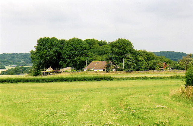
Backwell: Teagues Colliery
The waste tip of an early 19th century coal mine on Backwell Common, now covered in trees. James Teague (1750-1818), its developer, was an ironmaster and owner of coal pits in the Forest of Dean. For further information see Ralph Anstis, The Industrial Teagues and the Forest of Dean, Allan Sutton, 1990. Seen from one of the numerous public footpaths in the parish
 Map © Crown Copyright")
TIP: Click the map for more Large scale mapping
- Grid Square
- ST4869, 30 images (more nearby 🔍)
- Photographer
- Martin Bodman (more nearby)
- Date Taken
- Sunday, 6 July, 2003 (more nearby)
- Submitted
- Tuesday, 20 December, 2005
- Subject Location
-
OSGB36:
 ST 485 699 [100m precision]
WGS84: 51:25.5453N 2:44.5265W - Camera Location
-
OSGB36: ST 484 697