2005
TF2436 : Farmland, Mill Lane, Bicker, Lincs
taken 18 years ago, near to Hoffleet Stow, Lincolnshire, England
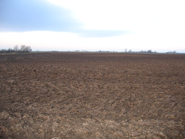
Farmland, Mill Lane, Bicker, Lincs
View N from the B1181. This is one of the hilliest, not flattest, parts of the Fens; once the Bicker Haven tidal estuary, this farmland occurs on depositional banks of pale-toned silt, saltern remnants and intervening low-lying darker former creek beds. The contours on the map show these 'hills' to rise to over 5 metres above sea level.
 Map © Crown Copyright")
TIP: Click the map for more Large scale mapping
- Grid Square
- TF2436, 12 images (more nearby 🔍)
- Photographer
- Rodney Burton (more nearby)
- Date Taken
- Friday, 23 December, 2005 (more nearby)
- Submitted
- Sunday, 25 December, 2005
- Subject Location
-
OSGB36:
 TF 24254 36760 [1m precision]
WGS84: 52:54.8342N 0:9.2160W - Camera Location
-
OSGB36: TF 24254 36664