2008
NO5608 : Perspex Mapping Board
taken 16 years ago, 3 km from Drumrack, Fife, Scotland
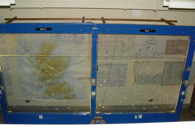
Perspex Mapping Board
 Map © Crown Copyright")
TIP: Click the map for more Large scale mapping
- Grid Square
- NO5608, 78 images (more nearby 🔍)
- Photographer
- Malcolm Carruthers (more nearby)
- Date Taken
- Thursday, 28 August, 2008 (more nearby)
- Submitted
- Saturday, 6 September, 2008
- Subject Location
-
OSGB36:
 NO 568 089 [100m precision]
WGS84: 56:16.2366N 2:41.8894W - Camera Location
-
OSGB36: NO 568 089
- View Direction
- Northeast (about 45 degrees)