2008
SP7221 : Bridge over River Ray
taken 16 years ago, 3 km from Quainton, Buckinghamshire, England
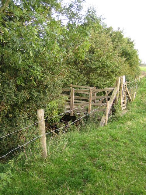
Bridge over River Ray
This small bridge connects two grazing fields near to the hamlet of Shipton Lee. About 300m to the west, the stream that barely flows under the bridge is marked on OS maps as the River Ray. This is likely to be because the river is fairly significant and its source is only 2km to the east in a spring on the northern slope of Grange Hill, SP73982127. To the west the river joins the River Cherwell at Islip Weir about 22km away, which itself joins the River Thames (or Isis) in Oxford.
 Map © Crown Copyright")
TIP: Click the map for more Large scale mapping
- Grid Square
- SP7221, 18 images (more nearby 🔍)
- Photographer
- Andy Gryce (more nearby)
- Date Taken
- Saturday, 30 August, 2008 (more nearby)
- Submitted
- Friday, 12 September, 2008
- Subject Location
-
OSGB36:
 SP 724 215 [100m precision]
WGS84: 51:53.2524N 0:56.9316W - Camera Location
-
OSGB36: SP 724 215
- View Direction
- East-southeast (about 112 degrees)