2005
SU7073 : Oxford Road
taken 19 years ago, near to Reading, England
This is 1 of 5 images, with title Oxford Road in this square
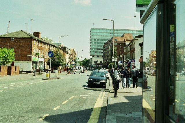
Oxford Road
The western fringe of Reading town centre, with the Renaissance Hotel to the right. A very mixed area in all senses. This used to be the main road from Reading to Birmingham via Oxford, the A42 and later the A329. It's now bypassed.
 Map © Crown Copyright")
TIP: Click the map for more Large scale mapping
- Grid Square
- SU7073, 378 images (more nearby 🔍)
- Photographer
- Rosalind Mitchell (more nearby)
- Date Taken
- Thursday, 12 May, 2005 (more nearby)
- Submitted
- Saturday, 14 May, 2005
- Subject Location
-
OSGB36:
 SU 709 733 [100m precision]
WGS84: 51:27.2925N 0:58.8248W - Camera Location
-
OSGB36: SU 709 733
- View Direction
- East-northeast (about 67 degrees)