More: Over Time · Recent · Tagged · Map · Browser · Others
Images of:

TM4281 : The Street sign by Geographer
TM4280 : Strawberry Lane by Geographer
TM4279 : Strawberry Lane by Geographer
TM4280 : St Andrew's church in Westhall - commemorative plaque in tower by Evelyn Simak
TM4281 : Low Road, Bampton Street by Geographer
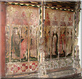
TM4280 : St Andrew's church in Westhall - C15 screen panels (south) by Evelyn Simak
TM4280 : Footpath off Bacon's Green Road by Geographer
TM4280 : Roadsign on Strawberry Lane by Geographer
TM4280 : St Andrew's church in Westhall - view west from chancel by Evelyn Simak
TM4282 : Footpath to Station Road by Geographer
TM4280 : Victorian postbox, Westhall by Evelyn Simak
TM4280 : Plaque for WW1 memorial pulpit by Helen Steed
TM4282 : Station Road sign by Geographer
TM4280 : Strawberry Lane, Westhall by Geographer
TM4281 : Country cottage in Brampton by Evelyn Simak
TM4282 : Moll's Lane by Geographer
TM4280 : Rural lane past Westhall by Evelyn Simak
TM4282 : Moll's Lane by Geographer
TM4280 : Victorian postbox set into a garden wall, Westhall by Evelyn Simak
TM4281 : Telephone Box & Moll's Lane Postbox by Geographer
TM4281 : Grove Cottages by JThomas
TM4280 : Strawberry Lane by Geographer
TM4279 : Footpath to Church Farm & entrance to Low Farm by Geographer
TM4281 : Beacon Farm, Westhall by Adrian S Pye
TM4280 : Church Hill, Westhall by Geographer
TM4279 : B1124 at Westhall by Adrian S Pye
TM4282 : Country Road by Ashley Dace
TM4282 : Farm Track And Footpath by Keith Evans
TM4280 : St Andrew's church in Westhall - shrouded cross by Evelyn Simak
TM4279 : Junction on the B1124 by JThomas
TM4282 : Station Road looking towards the A145 by Geographer
TM4280 : Lectern of St.Andrew's Church by Geographer
TM4279 : B1124 Halesworth Road, Sotherton by Geographer
TM4281 : Cart sheds at Old Parsonage Farm, Brampton by Adrian S Pye
TM4281 : Postbox and disused telephone kiosk at Brampton Street by Evelyn Simak
TM4281 : Sandy Lane Bridleway by Geographer
TM4280 : Bacon's Green Road by Geographer
TM4279 : B1124 Beccles Road by Geographer
TM4280 : Inside of St.Andrew's Church by Geographer
TM4279 : Brooke Farm from the road by Adrian S Pye
TM4280 : Worn floor by Keith Evans
TM4282 : Station Road & the footpath to Station Road by Geographer
TM4282 : Footpath/farm driveway crossroads by Glen Denny
TM4279 : B1124 Beccles Road to Holton by Geographer
TM4280 : Red box by Keith Evans
TM4280 : Bacon's Green Road & footpath by Geographer
TM4281 : Elizabeth II postbox and phonebox on Moll's Lane, Brampton by JThomas
TM4282 : Northern end of Moll's Lane Brampton by Adrian S Pye
TM4279 : B1124 Beccles Road by Geographer
TM4279 : Footpath And Farm Entrance by Keith Evans
TM4281 : T Junction, Brampton Street by Trevor Alder
TM4282 : Towards Hollybush Farm by Graham Horn
TM4280 : Westhall (Suffolk) St Andrew's Church by ChurchCrawler
TM4279 : Bridge across stream by Claire Haystead
TM4280 : The World War One Memorial at Westhall by Adrian S Pye


showing 55 of About 184 results. Explore these images more: in the Browser or in the standard search (may return slightly different results).
You are not logged in login | register
showing 55 of About 184 results. Explore these images more: in the Browser or in the standard search (may return slightly different results).