Your search for images, in topic Stellar Examples Game - Information, in order, returns
693 images:
( Page 1 2 3 4 5 6 7 8 ... next >> ) [refine search]
|
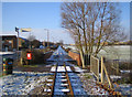
Leighton Buzzard: Narrow gauge railway
by Nigel Cox geograph for square SP9325 Category: Railway (narrow gauge) The railway was originally built in 1919 to carry sand from nearby quarries to the now dismantled Leighton Buzzard to Dunstable standard gauge railway line close to... (more)
|
|
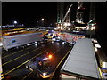
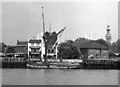
Loading the Holland ferry, Harwich
by Rudi Winter for square TM2332 Tags: [top:Coastal] [top:Docks, Harbours] [top:Estuary, Marine] [top:Roads, Road transport] [type:Extra] [subject:ferry] [forum:Otdh] Stena operate a pair of ferries out of Harwich, the Stena Hollandica (shown here) and the Stena Britannica, which each run once a day to Hoek van Holland and back, each... (more)
|
|
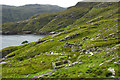
Gearraidh Lotalgear
by Mick Garratt geograph for square NB2201 Tags: [top:Coastal] [top:Derelict, Disused] [top:Historic sites and artefacts] [Black House] [coast] [deserted] [type:Geograph] [subject:ruin] [ruin] [township] [village] Compared to west coast the east coast of Harris is rugged and harsh, lacking the fertile machair found on the western coast of the islands. Even today with no white sandy... (more)
|
|
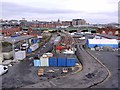
Forth Banks Goods Yard from Redheugh Bridge
by Andrew Curtis geograph for square NZ2463 Tags: [top:City, Town centre] [top:Industry] [top:Lowlands] [top:Railways] View slightly south of the position in NZ2463 : Forth Banks Goods Yard from Redheugh Bridge
|
|
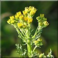
Ragwort (Jacobaea vulgaris) - flowers
by Evelyn Simak for square TG3203 Tags: [top:Wild Animals, Plants and Mushrooms] [type:Close Look] This plant contains pyrrolizidine alkaloids, which are hepatotoxic and can cause complete liver failure. There is, however, no evidence that ragwort causes harm by... (more)
|
|
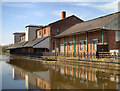
Leeds and Liverpool Canal, Disused Warehouse at Wigan Pier
by David Dixon geograph for square SD5705 Tags: [top:Canals] [top:Derelict, Disused] [top:Industry] [19th century] [canal] [Canopies] [grain warehouse] [canal:Leeds and Liverpool] [nineteenth century] [Victorian] [warehouse] Warehouses numbers 2 and 3 at Wigan Pier date from the 1890s and were used to store flour, grain, cotton and even cement. Goods would be picked up from, and dropped into,... (more)
|
|
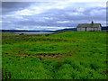
The Duke Of Sutherland's Luncheon Hut
by Donald H Bain geograph for square NC5510 Tags: [top:Derelict, Disused] [top:Farm, Fishery, Market Gardening] [top:Housing, Dwellings] [subject:hut] By the year 1876 The Duke of Sutherland had decided to create 2000 acres of new farmland around the north side of Loch Shin, he did this by using the James Fowler Steam... (more)
|
|
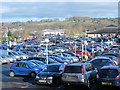
SNOT FAIR, SNOT FAIR
by Mike Quinn geograph for square NY9364 Tags: [top:City, Town centre] [top:Roads, Road transport] [subject:car park] Are you sitting comfortably preferably in a darkened room with a damp towel wrapped round your head and a box of paracetamol to hand? Then Ill begin.
Once upon a... (more)
|

|
Sunset over Longships lighthouse from Land's End
by Steve Fareham for square SW3125 Tags: [top:Air, Sky, Weather] [top:Coastal] [top:Communications] [top:Estuary, Marine] [county:Cornwall] [Lands End] [lighthouse] [place:Longships] [trinity house] From Trinity House website: Link
|
|
Why are AA vans yellow?
by Mick Garratt geograph for square NY4316 Tags: [top:Sport, Leisure] [subject:lodge] [former:shooting lodge] [Shooting Lodge] Oh I love pieces of useless trivia. More later. The photo was taken in Martindale, an isolated valley in the north east Lakes. Famous for its herd of red deer which, as... (more)
|
|
Hutton's Unconformity, Siccar Point
by Anne Burgess geograph for square NT8171 Category: Geological feature This spot is a mecca for geologists from all over the world, because it was here that James Hutton made some of the key observations that underpin the science of geology.... (more)
|
|
Drystone walls near Whaw
by Maigheach-gheal geograph for square NY9804 Tags: [top:Boundary, Barrier] [top:Uplands] [bracken] [drystone walls] The valley is criss-crossed with drystone walls.
Drystone walls are built without mortar, and their stability they can stand for 200 years is due to the skill of... (more)
|
|
Taking time out at the beach hut
by Neil Theasby for square TM0112 Tags: [top:Coastal] [top:Village, Rural settlement] [subject:hut] [bucket:Informative] By West Mersea Beach. She is reading a book while he takes forty winks. And that basically explains what beach huts are for.
Beach huts really started to be used in... (more)
|
|
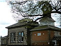
The Red Hall at Bourne, Lincolnshire
by Rex Needle geograph for square TF0919 Tags: [top:Historic sites and artefacts] [subject:building] The Grade II listed Red Hall is the most famous secular building in Bourne and has survived several attempts to have it pulled down. It was built in 1605 by Gilbert... (more)
|
|
The Arcade, 36 High Street, Swanage
by Jo and Steve Turner geograph for square SZ0378 Tags: [top:Business, Retail, Services] [top:City, Town centre] [top:Historic sites and artefacts] [subject:cafe] Grade II Listed building of 1896 designed by the Weymouth architect G. R. Crickmay at the junction of High Street and Kings Road East. There was no original purpose it... (more)
|
|
Gourock Bay, Holy Loch and Loch Long, from Lyle Hill, Greenock - 1
by Terry Robinson for square NS2477 Tags: [top:Coastal] [top:Defence, Military] [top:Estuary, Marine] [top:Historic sites and artefacts] [top:People, Events] [top:Suburb, Urban fringe] Holy Loch is in the far middle of the picture, immediately above the St John's Church Spire
During WW2 its sheltered waters were used by the Royal Navy as a... (more)
|
|
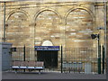
Newton Building, Talbot Street, Nottingham
by Stephen Richards geograph for square SK5740 Tags: [top:Educational sites] [1950s-1970s architecture] [subject:building] [listed building] Very striking, especially against a blue sky. A big slab with an entrance range at its feet. "Stylistically American stripped Beaux-Arts classicism". Lots of... (more)
|
|
Scotland Street Tunnel entrance, Waverley Station
by kim traynor for square NT2573 Category: Tunnel entrance The entrance to the Scotland Street Tunnel opposite Platform 19. The original Canal Street station on the later Waverley site lay on a north-south orientation, unlike the... (more)
|
|
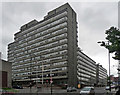
Pennine Centre, Tenter Street, Sheffield (1)
by Stephen Richards geograph for square SK3587 Tags: [top:Business, Retail, Services] [1950s-1970s architecture] A huge office complex consisting of five blocks, the nearest, Griffin House, rising to thirteen storeys. Built 1973-75. The architects were a local firm, Richard... (more)
|
|
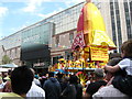
Juggernaut - New Street, Birmingham
by Martin Richard Phelan for square SP0786 Tags: [top:Business, Retail, Services] [top:City, Town centre] [top:Lowlands] [top:People, Events] [top:Sport, Leisure] [annual festival] [place:Birmingham] [place:High Street Birmingham] [Hindu Chariot Festival] [Hindu faith] [juggernaut] [place:New Street Birmingham] [Ratha Yatra] [Sir John Mandeville] [temple car] [place:West Midlands] The Hindu annual Chariot Festival was first reported on in the 14th century in India by Sir John Mandeville, while in the country on his travels. This festival also takes... (more)
|
|
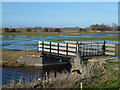
The "second" bridge on Guyhirn Wash - The Nene Washes
by Richard Humphrey geograph for square TF3801 Tags: [top:Rivers, Streams, Drainage] [bridge] [Drain] [leam] [Nene Washes] [washland] This is the second bridge over Morton's Leam which you come to when accessing the washland from Rings End. This bridge was rebuilt in 2011, see... (more)
|
|
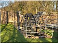
Reconstructed Water Wheel at Stanley Mill, Stanley Bank
by David Dixon geograph for square SJ5396 Tags: [top:Industry] [top:Park and Public Gardens] [top:Suburb, Urban fringe] [industrial heritage] [Sankey Valley Park] [water wheel] Powered by water, Stanley Iron Slitting Mill, built in 1773, heated and rolled iron ingots, forged at Carr Mill, into sheets which were then slit into bars for use in... (more)
|
|
Hedon Aerodrome
by Paul Glazzard geograph for square TA1729 Category: Airfield (disused) In 1888 a race course with a grandstand was set up here in the fields west of Hedon which was said by some to have the longest "straight" in the country. By... (more)
|
|
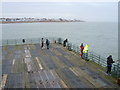
On the fishing deck at Deal Pier
by Marathon geograph for square TR3852 Tags: [top:Sport, Leisure] [fishing] [pier] Deal has had three separate piers in its history. The first, built in 1838, was designed by Sir John Rennie. After its wooden structure was destroyed in an 1857 gale, it... (more)
|
|
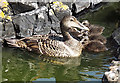
Eider Duck and Ducklings (Somateria mollissima)
by Anne Burgess for square NM3236 Tags: [top:Wild Animals, Plants and Mushrooms] [Birds] I was alerted to the presence of this little family by the splash as they leapt into the water of a rather murky rock pool. Eider drakes play no part in incubating the... (more)
|
|
Mouth of River Wandle
by Robin Webster geograph for square TQ2575 Tags: [top:City, Town centre] [top:Docks, Harbours] [top:Rivers, Streams, Drainage] There is a weir at the mouth, intended to have a central moving section that only lowered at higher tide levels, so allowing deep draught vessels to enter when the tide... (more)
|
|
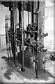
The Pendulum at Cooke's Explosives
by Arthur C Harris for square SH6239 Tags: [top:Derelict, Disused] [top:Industry] Inside the Pendulum Shed at former site of Cooke's Explosives, here the quality and power of the explosives was tested. A large cannon on tracks was pushed up to the... (more)
|
|
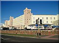
Norbreck Castle Hotel, Blackpool
by Tricia Neal geograph for square SD3140 Tags: [top:Business, Retail, Services] [top:City, Town centre] [top:Sport, Leisure] [Blackpool] [hotel] [Norbreck Castle Hotel] [Queens Promenade] [Shorrocks] On Queen's Promenade, Blackpool, at the junction with Norbreck Road. Originally built as a large private country house in 1869, it was bought in the late 1800s by... (more)
|
|
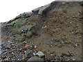
Eroding cliff
by Hugh Venables for square NB4056 Tags: [top:Coastal] Interesting deposits revealed by the coastal erosion. Compare to SW3530 : Climate history revealed! from Cornwall. Here the raised beach and glacial deposits are the other way around. This is... (more)
|
|
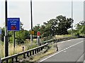
Southbound M42, Emergency Refuge Area 6388B
by David Dixon geograph for square SP1879 Tags: [top:Roads, Road transport] [6338B] [blue sign] [emergency refuge area] [emergency telephone] [ERA] [hard shoulder] [motorway:M42] [Motorway] [motorway sign] [SOS] In areas where an Active Traffic Management (ATM) Scheme is in force, the hard shoulder may be used as a running lane. In such areas, Emergency Refuge Areas (ERA) have... (more)
|
|
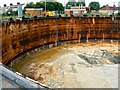
Site of gasholder, Iffley Road, Swindon (1 of 5) 08 August 2013
by Brian Robert Marshall geograph for square SU1485 Tags: [top:Energy infrastructure] [top:People, Events] [top:Suburb, Urban fringe] [Gasholder] [gasholder removed] Access by permission. The bottom of the hole can at last be seen. As bottoms go, one of the less exciting ones I've encountered albeit larger, and soon to be covered up.
|
|
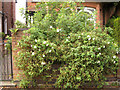
Rosa spinosissima hybrid 'Stanwell Perpetual', York Road front garden
by Robin Stott for square SP3165 Tags: [top:Housing, Dwellings] [top:Lowlands] [top:Suburb, Urban fringe] [postcode district:CV31] [garden plant] [place:Royal Leamington Spa] It was like meeting an old friend: the many-petalled, sweetly scented, soft pink muddle-centred flowers, late summer blooms, prickly shoots, the greyish-green leaves... (more)
|
|
Llanfairpwllgwyngyll: plaque atop the Marquess of Angleseys Column
by Chris Downer for square SH5371 Tags: [top:Suburb, Urban fringe] [column] [Plaque] [statue] Above one's head on reaching the top of SH5371 : Llanfairpwllgwyngyll: Marquess of Angleseys Column and stepping out onto the platform, this fascinating plaque is difficult to view because of the windy... (more)
|
|
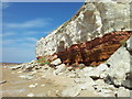
Hunstanton's famous stripy cliffs
by Helen Steed geograph for square TF6741 Tags: [top:Coastal] [top:Geological interest] [top:Rocks, Scree, Cliffs] Very unusually for the east coast, the resort of Hunstanton faces westwards out over the Wash, the cliffs themselves run from Hunstanton promenade to St Edmunds point... (more)
|
|
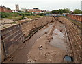
Hull, HU1
by David Hallam-Jones geograph for square TA1028 Tags: [top:City, Town centre] [top:Coastal] [top:Derelict, Disused] [top:Docks, Harbours] [top:Historic sites and artefacts] [former dry dock] This is the former Central Dry Dock (a.k.a. South End Dock) on the west bank of the River Hull opposite The Deep public aquarium and near to the rivers outfall... (more)
|
|
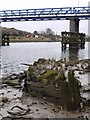
Remains of the Ryton Wherries, west of Newburn Bridge
by Andrew Curtis geograph for square NZ1665 Tags: [top:Docks, Harbours] [top:Estuary, Marine] [top:Historic sites and artefacts] [top:Lowlands] [top:Rivers, Streams, Drainage] |
|
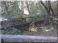
Coal Barge, Etherow Country Park
by Tom Hindley geograph for square SJ9791 Tags: [top:Canals] [top:Lakes, Wetland, Bog] [top:Park and Public Gardens] [top:Rivers, Streams, Drainage] [top:Sport, Leisure] Rusted remains of an abandoned coal barge in Etherow Country Park.
Open-cast coal mining in Ernocroft and Long Alders Wood (which overlook Etherow Country Park) provided... (more)
|
|
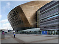
Wales Millennium Centre
by David Dixon geograph for square ST1974 Tags: [top:City, Town centre] [top:Public buildings and spaces] [top:Sport, Leisure] [21st century] [arts centre] [millennium] [twenty first century] Wales Millennium Centre (Canolfan Mileniwm Cymru) is an arts centre at the northern end of Roald Dahl Place in the Cardiff Bay area. It comprises one large theatre and... (more)
|
|
Site of RNAS Newhaven
by Simon Carey geograph for square TQ4500 Category: Military installation (disused) In 1917 the Royal Navy built a seaplane base here to protect the nearby port. Built initially with wooden hangars they were replaced in 1918 by metal hangars of which... (more)
|
|
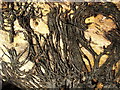
Rhizomorphs (thick fungal threads) of Armillaria species
by Lairich Rig for square NS4473 Category: Fungi Tags: [top:Woodland, Forest] [bucket:Closeup] [fungus] [bucket:Life] [rhizomorph] These tough black threads are covering a piece of fallen wood; formerly, this "Honey Fungus" would have been identified as Armillaria mellea, but it is now... (more)
|
|
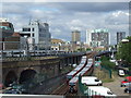
DLR at Royal Mint Street
by Malc McDonald geograph for square TQ3380 Tags: [top:Railways] [car park] [DLR] [docklands light railway] [place:East London] This view was taken from a multi-storey car park next to Tower Gateway station.
Tower Gateway was the original terminus of the Docklands Light Railway, opened in 1987.... (more)
|
|
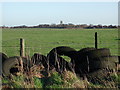
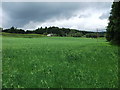
Arable silage crop
by John Haynes geograph for square SJ2837 Tags: [top:Farm, Fishery, Market Gardening] [top:Lowlands] This former grass field was ploughed this spring and resown with a crop that is coming back into fashion again after an absence of 50 years or so. It is arable silage, a... (more)
|
|
Riddings House
by Rob Howl geograph for square SK4352 Tags: [top:Historic sites and artefacts] [top:Village, Rural settlement] Riddings House the family home of the Oakes family (early industrialists).
The worlds first oil refinery was at Riddings, distillation of crude oil (a natural oil well... (more)
|
|
|
Riddings House
by Rob Howl geograph for square SK4352 Tags: [top:Historic sites and artefacts] [top:Village, Rural settlement] Riddings House the family home of the Oakes family (early industrialists).
The worlds first oil refinery was at Riddings, distillation of crude oil (a natural oil well... (more)
|
|
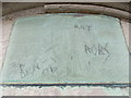
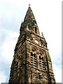
Roystonhill Spire
by Lairich Rig for square NS6066 Category: Church spire Tags: [top:Religious sites] [church spire] [place:Roystonhill] See NS6066 : Townhead-Blochairn Church of Scotland, Roystonhill for more information on the spire. The photograph was taken from the area just to the south of the spire; there was an inscription there:
"On the... (more)
|
|
Goonvean China Clayworks - Cornish beam engine
by Chris Allen for square SW9455 Tags: [top:Historic sites and artefacts] [top:Quarrying, Mining] [beam engine] [china clay quarrying] [Cornish beam engine] [pumping engine] [stationary steam engine] 50" Cornish beam engine of 1863 by Harvey & Co of Hayle. Installed 4th hand in 1910. Dismantled by Century millwrights in September 2008 and placed in store. It... (more)
|
|
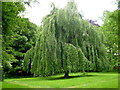
A Weeping Beech in Dun na Ri Forest Park
by D Gore geograph for square N7897 Tags: [top:Country estates] [top:Historic sites and artefacts] [top:Lowlands] [top:Park and Public Gardens] [top:Paths] [top:Rivers, Streams, Drainage] [top:Woodland, Forest] This magnificent tree, here at full height with its glorious spread of cascading branches hidden behind a thick screen of leaves, is just one of many fine trees to be... (more)
|
|
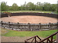
For the horses
by Neil Owen geograph for square SP3475 Category: Roman fort The Gyrus, or horse training ring, at Lunt appears to be unique in the Roman world. At over 34m (101 ft) in diameter it's thought that the cavalry would use it for... (more)
|
|
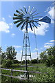
Wind powered water pump, Sedge Fen
by Rob Noble geograph for square TL5670 Tags: [top:Flat landscapes] [top:Lakes, Wetland, Bog] [fenland] [Nature Reserve] [water pump] [Wetland] The pump lifts river water up onto Sedge Fen via a newly constructed channel under Wicken Lode, in order to help preserve the important wetland habitat, which is one of... (more)
|
|
The 'Prospect of Whitby', Wapping
by Dr Neil Clifton geograph for square TQ3580 Category: Inn The 'Prospect of Whitby', probably London's oldest Thames-side inn, was certainly in business as long ago as 1520, when it was known as the Devil's... (more)
|
Search took 0.01 secs, ( Page 1 2 3 4 5 6 7 8 ... next >> ) [refine search]
View/Download: Coverage Map Statistics KML geo RSS GPX Try opening in Browser function (Experimental, may not work!)Found these results useful? Please Donate
|