Shared description
Browns Lane
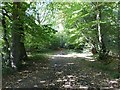
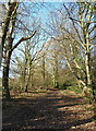
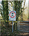
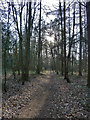
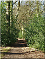
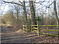
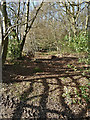
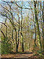
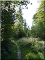
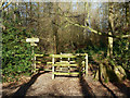
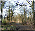
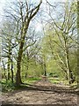
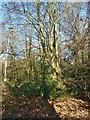
Browns Lane is a public byway open to all traffic from March to October inclusive, but is effectively a bridleway from November to April.
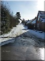
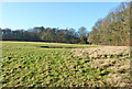
It meanders in a roughly northwesterly direction from Kiln Lane north of Cholesbury at SP93310783 to the hamlet of Hastoe at SP91801937, rising 50m from 183m to 233m in the process. At its Hastoe end it has a number of houses.
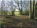
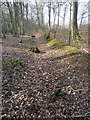
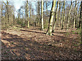
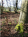
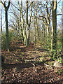
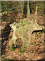
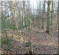
For much of its length it passes through heavily wooded countryside with Haresgarden Wood to its left (SW) and first High Scrubs then Shrubb's Wood on its right (NE).
It meanders in a roughly northwesterly direction from Kiln Lane north of Cholesbury at SP93310783 to the hamlet of Hastoe at SP91801937, rising 50m from 183m to 233m in the process. At its Hastoe end it has a number of houses.
For much of its length it passes through heavily wooded countryside with Haresgarden Wood to its left (SW) and first High Scrubs then Shrubb's Wood on its right (NE).
by Rob Farrow
Created: Mon, 16 Jan 2012, Updated: Mon, 16 Jan 2012
22 images use this description:
Shared descriptions
This shared description
The 'Shared Description' text on this page is © copyright 2012 Rob Farrow.
Shared descriptions are specifically licensed so that contributors can reuse them on their own images, without restriction.
About shared descriptions
These Shared Descriptions are common to multiple images.
For example, you can create a generic description for an object shown in a photo, and reuse the description on all photos of the object. All descriptions are public and shared between contributors, i.e. you can reuse a description created by others, just as they can use yours.
Explore images
View images using this "Browns Lane" Shared Description
View images mentioning the words [Browns Lane] anywhere in text
Links for SP9307
This description is located in SP9307.
Other shared descriptions
Descriptions nearby
Related descriptions
- Cholesbury Camp - Iron Age Fort
By Rob Farrow. Used on 15 images
- Pavis Wood
By Rob Farrow. Used on 8 images
The above selections are automatic and approximate, it might not always select closely matching descriptions