Shared description
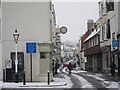
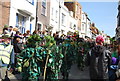
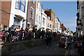
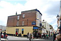
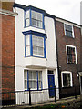
High Street, Hastings
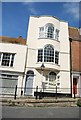
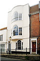
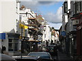
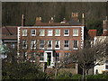
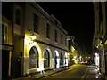
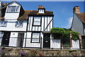
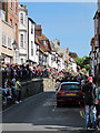
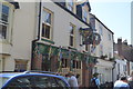
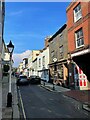
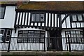
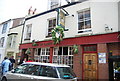
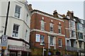
At just less than 0.4 miles long the High Street has over one hundred listed buildings and structures, accounting for most of the Street.
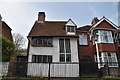
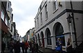
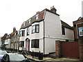
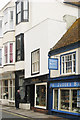
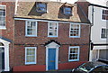
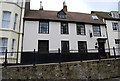
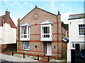
Running diagonally from South-West to North-East. The South-West half starts from the junction of East Parade (A259), the buildings are predominantly shops, with flats above and contains a varied mix of shops such as antique shops, bric-a-brac, art shops and galleries, pubs and cafés, and the 'famous' Judge's Bakery. Half way along the street can be found, a cinema, the old town hall, and old post office. The middle to North-West is predominately housing, and near the end St Mary's of the Sea church. The road then re-joins with The Bourne (also the A259).
Running diagonally from South-West to North-East. The South-West half starts from the junction of East Parade (A259), the buildings are predominantly shops, with flats above and contains a varied mix of shops such as antique shops, bric-a-brac, art shops and galleries, pubs and cafés, and the 'famous' Judge's Bakery. Half way along the street can be found, a cinema, the old town hall, and old post office. The middle to North-West is predominately housing, and near the end St Mary's of the Sea church. The road then re-joins with The Bourne (also the A259).
Created: Sun, 8 Nov 2009, Updated: Sat, 3 Feb 2024
245 images use this description. Preview sample shown below:
... and 220 more images.
Shared descriptions
This shared description
The 'Shared Description' text on this page is © copyright 2009 Oast House Archive.
Shared descriptions are specifically licensed so that contributors can reuse them on their own images, without restriction.
About shared descriptions
These Shared Descriptions are common to multiple images.
For example, you can create a generic description for an object shown in a photo, and reuse the description on all photos of the object. All descriptions are public and shared between contributors, i.e. you can reuse a description created by others, just as they can use yours.
Explore images
View images using this "High Street, Hastings" Shared Description
View images mentioning the words [High Street, Hastings] anywhere in text
Links for TQ8209
This description is located in TQ8209.
Other shared descriptions
Descriptions nearby
- Eat @ The Stade
- All Saints' Street
- Hastings Contemporary
- Jerwood construction
- Old Town Hall Museum
- Jack in the Green Festival
- St Clement's church, Hastings
- Church of St Clement
- Hastings Lifeboat Station
- The Icehouse
- East Hill Lift Re-opening (27th March 2010)
- Hill Street
- Harbour Beach
- Shipwreck Museum
- Rock-a-Nore Road
- West Street
- Cobourg Place
- Happy Harold Trolley Bus
- East Hill Lift
- St Clements Caves (Smugglers Caves)
- Harbour Arm
- West Hill Lift
- East Parade
- 135 All Saints Street, Hastings
- Church of St Mary Star of the Sea
Related descriptions
- George Street
By Oast House Archive. Used on 114 images
- East Parade
By Oast House Archive. Used on 26 images
- West Street
By Oast House Archive. Used on 14 images
- Marine Parade
By Oast House Archive. Used on 11 images
- Carlisle Parade
By Oast House Archive. Used on 2 images
- St Mary's Terrace
By Oast House Archive. Used on 10 images
- East Beach Street
By Oast House Archive. Used on 13 images
The above selections are automatic and approximate, it might not always select closely matching descriptions