Showing most recent first, in descending order
2 images in cluster 220m or 725ft in SU7230
Image clustering - assigning images labels - is an automated process, based on the image title/description. It's not totally accurate, and can sometimes assign images to odd clusters
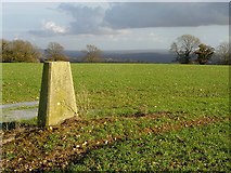
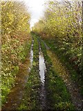
in SU7230, near Colemore, taken Tuesday, 28 November, 2006, by Hugh Chevallier
Explore these images in the Browser or Explore matching images including in surrounding squares (if any!)
All images  © Hugh Chevallier and licensed for reuse under this Creative Commons Licence
Other Automatic clusters in SU7230
- Button's Lane
- Farm
- Holtham Lane
- Looking
- Lane between Church Farm and Goleigh Farm
- Near
- Looking down Holtham Lane
- Pillar
- Narrow
- 220m or 725ft
- Keyham Farm
- Byway
- Wood