Showing most recent first, in descending order
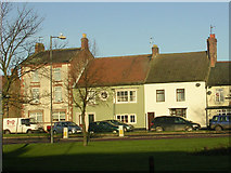
5 images in cluster A688 in NZ1826
Image clustering - assigning images labels - is an automated process, based on the image title/description. It's not totally accurate, and can sometimes assign images to odd clusters
in NZ1826, near Bishop Auckland
Explore these images in the Browser or Explore matching images including in surrounding squares (if any!)
Other Automatic clusters in NZ1826
- St Helen Auckland
- Darlington Road
- World Cup
- River Gaunless
- Oakley Cross Beck
- Shop
- Memorial Hall
- Old Hall
- Terraced Housing
- Woodhouse Lane
- Railway Line
- Street North
- A68 Junction
- Parish Church
- St Helen's Churchyard
- A688
- Village Centre
- Mill
- Sir Thomas Lipton Trophy
- Embankment
- Colliery Inclined Rail
- Manor Road
- Rail Track
- White
- West Auckland Post Office
- Wesleyan Chapel
- Millbank Primary School
- Tourist
- Approach
- Earl of Warwick
- East Green
- Houses in Front Street North
- Prince of Wales Pub
- Methodist Church
- Picture Date back to the 18th Century