Showing most recent first, in descending order
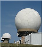
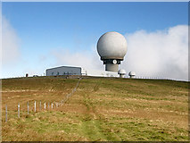
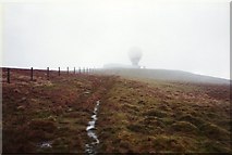
3 images in cluster Aircraft Tracking Station in NS8810
Image clustering - assigning images labels - is an automated process, based on the image title/description. It's not totally accurate, and can sometimes assign images to odd clusters
in NS8810, near Wanlockhead
Explore these images in the Browser or Explore matching images including in surrounding squares (if any!)
Other Automatic clusters in NS8810
- Golf Ball
- Lowther Hill and East Mount Lowther
- Shed
- Enterkin Pass
- Wanlockhead
- Radome
- Communications
- Southern Upland Way Near Lowther Hill
- Mast on Throw Rig
- Highest Point
- NATS Radar Station
- Access Road to the Radar Station
- Aircraft Tracking Station
- Compound
- Cloud
- Royal Canadian
- Control
- Miles
- Enterkin Burn
- Lowther Hill in 1986
- Enterkin Pass Path
- Flank of Lowther Hill