Showing most recent first, in descending order

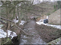
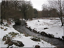
7 images in cluster Beamish Burn in NZ2054

Image clustering - assigning images labels - is an automated process, based on the image title/description. It's not totally accurate, and can sometimes assign images to odd clusters

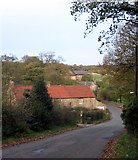
in NZ2054, near Stanley/NZ1952


NZ2054 : Beamish Burn by Mick Garratt
Beamish Burn
When: 21 November, 2021
By: Mick Garratt
NZ2054 : Field adjacent to minor road by Trevor Littlewood
Field adjacent to minor road
When: 23 August, 2013
By: Trevor Littlewood
NZ2054 : Ordnance Survey Cut Mark by Peter Wood
Ordnance Survey Cut Mark
When: 10 May, 2013
By: Peter Wood
NZ2054 : Beamish Burn by Peter Wood
Beamish Burn
When: 10 May, 2013
By: Peter Wood
NZ2054 : Beamish Burn by Les Hull
Beamish Burn
When: 12 January, 2010
By: Les Hull
NZ2054 : Beamish Burn by Les Hull
Beamish Burn
When: 12 January, 2010
By: Les Hull
NZ2054 : Beamish Burn Bridge by Alan Fearon
Beamish Burn Bridge
When: 10 November, 2005
By: Alan Fearon

Explore these images in the Browser or Explore matching images including in surrounding squares (if any!)


Other Automatic clusters in NZ2054

  1. Beamish Burn
  2. South Causey
  3. Beamish Burn Bridge
  4. Carrickshill Wood
  5. Footpath
  6. Boghouse Lane
  7. Stanley
  8. Entrance
  9. Blue Bell
  10. Licensed Premises on Beamishburn Road
  11. Mole Hill Farm
  12. North
  13. Picnic Area in Carrickshill Wood
  14. Beamish Hall
You are not logged in login | register