Showing most recent first, in descending order
images in cluster Bridleway that Follows in SE1468
Image clustering - assigning images labels - is an automated process, based on the image title/description. It's not totally accurate, and can sometimes assign images to odd clusters
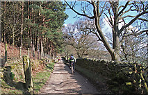
in SE1468, near Wath/SE1467, taken Wednesday, 25 March, 2015, by michael ely
Explore these images in the Browser or Explore matching images including in surrounding squares (if any!)
All images  © michael ely and licensed for reuse under this Creative Commons Licence
Other Automatic clusters in SE1468
- Gouthwaite Dam
- Gouthwaite Reservoir Dam
- Spring Wood
- Near
- Track to Sigsworth Grange
- Dales Trail
- Spring Wood Top
- Road
- Track from Gouthwaite Dam
- Field
- Tree
- Sheep
- Capacity of the Current Overflow
- Quarry
- Nidd Valley Light Railway
- Near Stripe Head Farm
- Low Stone in the Drystone Wall
- Foot of Gouthwaite
- East Facing Wall of an Outbuilding
- Yates Wood