Showing most recent first, in descending order
6 images in cluster Churchill in SO8779
Image clustering - assigning images labels - is an automated process, based on the image title/description. It's not totally accurate, and can sometimes assign images to odd clusters


Explore these images in the Browser or Explore matching images including in surrounding squares (if any!)
Other Automatic clusters in SO8779
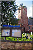
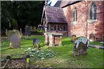
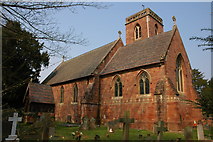
- Churchill Church
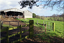
- Farmland Near
- St James's Church
- Footpath to Five Ways
- West
- Farmland North
- Looking East towards Churchill
- North-west of Churchill
- Continues towards Five Ways
- Field
- Pasture and Footpath
- Housing by Churchill Lane in Churchill
- Village
- Public Bridleway along Waggon Lane
- Junction with Waggon Lane
- Churchill Old Farm
- Blakedown
- Skyline is Bunker's Hill Wood
- Rocky Lane
- Attlee House
- Wheat
- Leads
- Converted Farm Buildings
- St James the Great Dates from 1868
- Post Box
- Pasture South-west of Churchill in Worcestershire
- Overgrown
- Approaching
- White Walled Building in the Middle