Showing most recent first, in descending order
images in cluster Footpath in SE1328
Image clustering - assigning images labels - is an automated process, based on the image title/description. It's not totally accurate, and can sometimes assign images to odd clusters
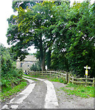
in SE1328, near Woodside/SE1328, taken Saturday, 12 September, 2020, by Humphrey Bolton
Explore these images in the Browser or Explore matching images including in surrounding squares (if any!)
All images  © Humphrey Bolton and licensed for reuse under this Creative Commons Licence
Other Automatic clusters in SE1328
- Meadway
- Fenwick Drive
- St Michael and All Angels Church
- Riding Hill
- Wood
- Carr House Road
- Green Lane
- Edgebank Avenue
- Loweswater Avenue
- Moresby Road
- Jagger Park Wood
- Erskine Parade
- Ullswater Drive
- Collinfield Rise
- Trees
- Egremont Crescent
- Kelmore Grove
- Rosley Mount
- Public Footpath
- Parish
- Near Royds Hall
- High Bentley Farm
- Manorley Lane
- Electricity Substation
- Low Bentley Farm
- Field