Showing most recent first, in descending order
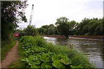
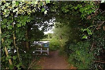
3 images in cluster Footpath in SU5097
Image clustering - assigning images labels - is an automated process, based on the image title/description. It's not totally accurate, and can sometimes assign images to odd clusters
Explore these images in the Browser or Explore matching images including in surrounding squares (if any!)
Other Automatic clusters in SU5097
- River Thames
- Lady and St Edmund
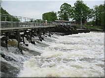
- Thames at Abingdon Weir
- River Thames at Abingdon Lock
- Thames Path
- Weir on the River Thames
- Flowing
- Abbey Stream
- Lock Keepers
- Narrowboat
- Radley
- Gates
- Ordnance Survey Cut Mark Benchmark Described
- Footbridge
- Oxford Road
- Downstream
- Bridge
- Boats
- Barton Fields
- Abbey Meadows
- Small Island in the Thames
- National Cycle Network
- Graves
- Waiting
- Flight
- Flood Markers
- Small Cemetery
- Royal Air Force 5th March 1957 Age
- Footpath
- Information Boards
- Plaque
- Overflow Ditch
- Going Upstream
- East to West
- Keeper's Cottage
- Fishing
- Station Closed to Passengers
- Looks Like
- School now Used as the Church Hall
- Recreational Area
- Weir Pool