Showing most recent first, in descending order
35 images in cluster Landcover: Suburban in SE0125 Image clustering - assigning images labels - is an automated process, based on the image title/description. It's not totally accurate, and can sometimes assign images to odd clusters
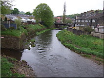
in SE0125 , near Hoo Hole
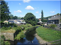
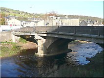
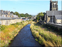
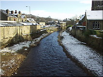
River Calder from New Road bridge, Mytholmroyd When: 25 July, 2015 By: Colin Pyle
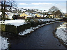
River Calder, Mytholmroyd When: 18 May, 2013 By: JThomas
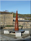
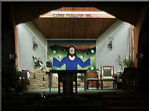
Sculpture in the car park, Church Street, Mytholmroyd When: 28 October, 2011 By: Humphrey Bolton
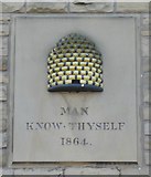
Beehive emblem on the former Co-operative store When: 28 October, 2011
By: Humphrey Bolton
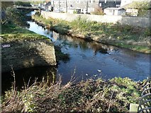
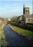
Confluence of Cragg Brook and the River Calder When: 28 October, 2011
By: Humphrey Bolton
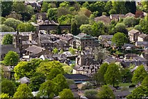
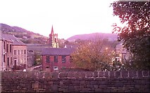
Autumn evening view in Mytholmroyd When: 13 October, 2011 By: David Clark
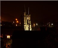
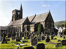
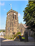
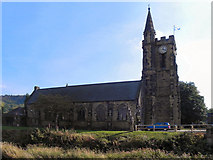
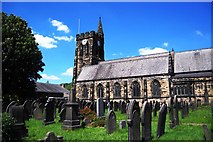
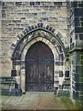
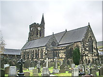
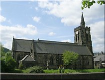
St Michaels Church Mytholmroyd When: 11 October, 2011 By: David Clark
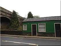
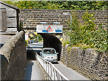
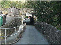
Thrush Hill Road Railway Bridge When: 24 July, 2011 By: David Dixon
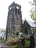
Mytholmroyd, St Michael's Church When: 3 September, 2010 By: David Dixon
St Michael's Church, Mytholmroyd When: 3 September, 2010
By: David Dixon
St Michael's Church, Mytholmroyd
When: 3 September, 2010
By: David Dixon
River Calder, Mytholmroyd When: 3 September, 2010
By: David Dixon
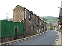
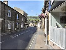
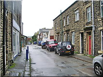
New Road, Mytholmroyd When: 3 September, 2010
By: David Dixon
Thrush Hill Road Bridge, Mytholmroyd When: 1 October, 2009 By: Humphrey Bolton
Mytholmroyd
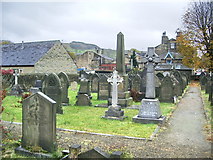
St Michael's Church and Graveyard When: 30 May, 2009 By: SMJ
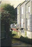
Balconies over the Cragg Brook, Mytholmroyd When: 16 October, 2008 By: Humphrey Bolton
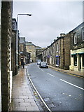
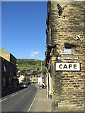
New Road, Mytholmroyd When: 28 September, 2008 By: michael ely
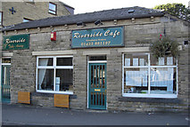
Riverside Cafe, Mytholmroyd When: 28 September, 2008
By: michael ely
The River Calder, Mytholmroyd When: 2 April, 2007 By: Paul Glazzard
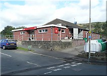
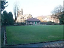
Mytholmroyd bowling green When: 14 January, 2007 By: NigglePics
River Calder at Mytholmroyd When: 4 February, 2003 By: Phil Champion
River Calder
at Mytholmroyd When: 4 February, 2003
By: Phil Champion
Explore these images in the Browser or Explore matching images including in surrounding squares (if any!)
Other Automatic clusters in SE0125
Hebden Royd Path Stake Lane New Road Landcover: Suburban Mytholmroyd Station Bridge Hall Bank Lane Scout Road Hollin Hey Cragg Brook St Michael's Church Shoulder of Mutton Stile River Calder Field Hebden Royd Footpath 59 View towards Mytholmroyd Farm Wall before the Flood Junction Blocked Fence Listed Grade II List Entry Seen Alongside Calder Valley Cut Hill Burnley Road Hebden Royd Footpath 62 Route 66 Railway Viaduct Old Maps Landcover: Urban Good Shepherd Catholic Church and Centre Rochdale Canal Public Footpath Housing Estate Stone Setts Station Access Ramp Sunday School Building Benchmark Described on the Bench Mark Database Estimates the Cost at 50,000 but Looking National Cycle Garden Goes through the Gate Ground of the Churchyard being Washed Methodist Chapel Mytholmroyd Bowling County Bridge Near Corner Cart Track Water Works Valve Marker Plate Three-arched Viaduct Designed by George Stephenson George Street Elphaborough Close