Showing most recent first, in descending order
images in cluster Lane in SO5931
Image clustering - assigning images labels - is an automated process, based on the image title/description. It's not totally accurate, and can sometimes assign images to odd clusters
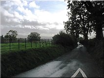
in SO5931, near Brockhampton/SO5931, taken Sunday, 20 October, 2013, by David Purchase
Explore these images in the Browser or Explore matching images including in surrounding squares (if any!)
All images  © David Purchase and licensed for reuse under this Creative Commons Licence
Other Automatic clusters in SO5931
- Posts were Created at the Brockhampton Estate
- Parkland at Brockhampton Court
- Brockhampton Cricket
- Wye Valley Walk
- South
- Text on each side of the Post
- Orchard at Totnor
- Trees by Brockhampton Court
- Brockhampton Cottage
- Brockhampton Parish Hall
- Public Footpath from All Saints Parish Church
- Brockhampton Cricket Club's Ground
- Situated by the Post Walk from Totnor
- Holy Trinity Church
- Minor Road
- Part of Brockhampton
- Valley Floor
- Ladyridge Farm
- Private House
- Olive Tree
- Farm Buildings
- Fishers Orchard
- Garden
- Village
- Country Lane
- Footpath Leads
- Perrystone Hill
- Near Plastre Tump
- Bank
- Gate Piers to Brockhampton Court
- Stream
- Hamlet
- Metalled Road
- Victorian Postbox