Showing most recent first, in descending order
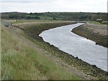
2 images in cluster Low Tide in TQ4204
Image clustering - assigning images labels - is an automated process, based on the image title/description. It's not totally accurate, and can sometimes assign images to odd clusters
Explore these images in the Browser or Explore matching images including in surrounding squares (if any!)
Other Automatic clusters in TQ4204
- Estate Map of Southease Viewed
- Bank of the River
- Old Lane to Stocks Ferry
- East
- South of Southease
- Flood Plain
- South Downs
- Near Southease
- Marks the Location
- Low Tide
- Old Course of River Ouse
- Long Brook
- Pylon
- Hill Farm
- Farm Track
- Southease Swing Bridge
- Tidal Flap for Land Drainage