Showing most recent first, in descending order
images in cluster Lumbutts in SD9623
Image clustering - assigning images labels - is an automated process, based on the image title/description. It's not totally accurate, and can sometimes assign images to odd clusters
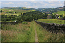
in SD9623, near Todmorden, taken Sunday, 7 July, 2019, by Chris Heaton
Explore these images in the Browser or Explore matching images including in surrounding squares (if any!)
All images  © Chris Heaton and licensed for reuse under this Creative Commons Licence
Other Automatic clusters in SD9623
- Withens Gate
- Calderdale Way
- Stoodley Pike
- Long Causeway
- Pennine Bridleway
- Looking
- Farm
- London Road
- Deum Stone
- Causeway from Mankinholes
- Mankinholes Village
- Long Stoop
- Broad Carr
- Langfield Common
- Edge
- Youth Hostel
- Heeley Hill
- Mankinholes Bank
- Water Troughs at Mankinholes
- Long Stoup
- Signpost
- East Scout
- Residential
- Old Wayside Cross
- Millennium Sculpture
- Field
- Estate Boundary Marker