Showing most recent first, in descending order
images in cluster Magna in SE1125
Image clustering - assigning images labels - is an automated process, based on the image title/description. It's not totally accurate, and can sometimes assign images to odd clusters
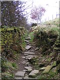
in SE1125, near Halifax, taken Sunday, 22 March, 2009, by Michael Steele
Explore these images in the Browser or Explore matching images including in surrounding squares (if any!)
All images  © Michael Steele and licensed for reuse under this Creative Commons Licence
Other Automatic clusters in SE1125
- Shibden Park
- Leeds Road
- Dark Lane
- Halifax Old Road
- Red Beck
- Shibden Hall Road
- Norcliffe Lane
- Break Neck Lane
- Track
- A58 Halifax Road
- Brighouse Footpath
- House
- Mineral Tramway
- Near
- Stone
- Cold Well Hill
- Hipperholme Station
- Railway Line
- Bank
- Field
- Boathouse
- Steps
- Footbridge
- Brighouse Bridleway
- Miniature Railway
- Junction
- Pylons
- Lower Place Farm
- Part of the Ancient
- Boating Lake
- Designed to Resemble a Large River Flowing
- Stile on Brighouse Footpath
- Ruin of Upper Place Farm
- Quarry Face
- Play Area
- Mytholme Bridge
- Medieval Holloway
- Informal Path
- Common Wood
- View from Cold Well Hill