Showing most recent first, in descending order
images in cluster Near in SD9321
Image clustering - assigning images labels - is an automated process, based on the image title/description. It's not totally accurate, and can sometimes assign images to odd clusters
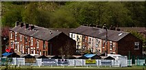
in SD9321, near Knowl Wood/SD9322, taken Saturday, 5 May, 2018, by Peter McDermott
Explore these images in the Browser or Explore matching images including in surrounding squares (if any!)
All images  © Peter McDermott and licensed for reuse under this Creative Commons Licence
Other Automatic clusters in SD9321
- Rochdale Canal
- Jubilee Mill
- Gordon Rigg's Garden Centre
- Winterbutlee Lock
- Scott Street
- Rochdale Road Walsden Todmorden
- Pennine Bridleway
- Lock 30
- Travis Mill Lock
- Railway Line
- Inchfield
- Beswick Street
- Walsden Water
- Border Rose
- Bowling Club
- Birks Lane
- Littleborough to Todmorden
- Lightbank Lock 31
- Waggon Horses
- Nip Square Lock No 29
- Cottage
- Footpath
- Looking North
- Unity Street
- Winterbutlee Railway Tunnel
- Church
- Cross Keys
- Moored
- Ground was Opened in a 16-a-side Match
- Ramsden Wood Road
- Calderbank Nurseries
- Stream
- St Peter's Gate
- Skew Bridge
- Bridge 35
- Chimney has been Shortened
- Old Milestone
- Blue Plaque
- Boiler House
- West Yorkshire OL14 6SX
- Scott Street Recreation Ground
- Peterbilt
- Peel Cottage Road
- Showing Position of Postbox