Showing most recent first, in descending order
2 images in cluster Sign in TQ6259
Image clustering - assigning images labels - is an automated process, based on the image title/description. It's not totally accurate, and can sometimes assign images to odd clusters
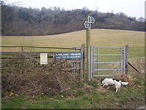
in TQ6259, near Wrotham Heath, taken Tuesday, 17 February, 2009, by David Anstiss
Explore these images in the Browser or Explore matching images including in surrounding squares (if any!)
All images  © David Anstiss and licensed for reuse under this Creative Commons Licence
Other Automatic clusters in TQ6259
- Nepicar Lane
- Road
- Farm
- North Downs
- Wrotham Water Farm
- Footpath to Wrotham Water
- North Downs Way
- Hognore Farm
- Looking
- Farmland
- Near Wrotham
- Pilgrims Way Road
- Junction
- Field
- M20
- Kent Countryside Near
- Distance and the Pilgrim's Way
- Wrotham Heath
- Footpath from A227 Gravesend Road
- A20
- Route of Pilgrims' Way
- Farmhouse
- Minor Lane
- Oast House
- Follows this side of the Tree Line
- Footpath across a Field
- Sheep Grazing North of Pilgrim's Way
- Sign
- M20 Overbridge