Showing most recent first, in descending order
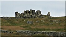
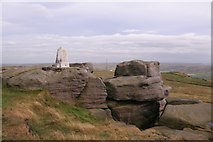
3 images in cluster Stone Hill in SD9326
Image clustering - assigning images labels - is an automated process, based on the image title/description. It's not totally accurate, and can sometimes assign images to odd clusters
Explore these images in the Browser or Explore matching images including in surrounding squares (if any!)
Other Automatic clusters in SD9326
- Landcover: Acid grassland
- Bride Stones Moor
- Trig Point
- Eastwood Road
- Landcover: Bog
- Windy Harbour Lane
- Rock
- Landcover: Improved grassland
- Whirlaw Common
- Approaching
- Great Bride Stones
- Bridestones Moor
- Calderdale Way
- Summit
- Stone Hill
- Looking
- Conditions
- Start
- Metres above Sea Level
- Mast
- Todmorden Centenary Way
- Triangulation Pillar
- Easter Island
- Face