Showing most recent first, in descending order
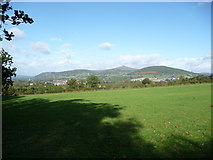
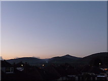
7 images in cluster Sugar Loaf in SO3013
Image clustering - assigning images labels - is an automated process, based on the image title/description. It's not totally accurate, and can sometimes assign images to odd clusters
in SO3013, near Abergavenny/Y Fenni
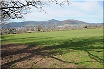
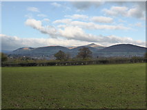
When: 21 November, 2013
By: Jeremy Bolwell
Explore these images in the Browser or Explore matching images including in surrounding squares (if any!)
Other Automatic clusters in SO3013
- Station Road
- Abergavenny Bus Station
- A40 Monmouth Road
- Near
- Abergavenny Sidings
- South from Abergavenny
- Abergavenny Hotel
- Building at Abergavenny
- Abergavenny Station Platform
- Mill Street
- Abergavenny Corner
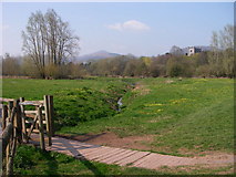
- Gavenny River
- Grade II Listed
- Town of Abergavenny
- Car Park
- Fosterville Crescent
- Entrance to Abergavenny
- Railway Lines
- Swan Hotel
- A465
- Station Enterprises Unit
- Display
- Plas Derwen
- Business
- Welsh Name
- Southern Edge
- Cross Street
- Sign Faces
- Stagecoach Bus
- Great Western Hotel
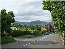
- Sugar Loaf
- Belmont Close
- Dark Green
- Houses were Built
- Cycle Route
- Oasis Sandwich Bar
- Cut Mark
- Coach in Abergavenny
- Electricity Substation
- Temporary Footbridge
- Mill Street Industrial Estate was Constructed
- Marches Line
- Hydrogen Vehicles
- Aldi Supermarket
- Transport for Wales Train
- Viewed on December 31st 2017
- Hanging from a Wall Bracket
- Information Board
- Looking Past
- Part of the Newport
- Recharging Area
- Row of Units
- West Bank
- Elizabeth II Postbox
- Bend in Holywell
- Fosterville Crescent Ascends
- Stone Circle