Showing most recent first, in descending order
3 images in cluster Trail in TQ0951
Image clustering - assigning images labels - is an automated process, based on the image title/description. It's not totally accurate, and can sometimes assign images to odd clusters
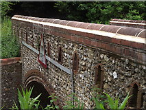
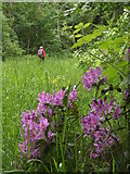
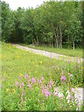
in TQ0951, near East Horsley, by Colin Smith
When: 10 June, 2012
When: 10 June, 2012
When: 14 July, 2007
Explore these images in the Browser or Explore matching images including in surrounding squares (if any!)
All images  © Colin Smith and licensed for reuse under this Creative Commons Licence
Other Automatic clusters in TQ0951
- Crocknorth Road
- Sheepleas
- Raven Arch
- Largest of the Bridges
- Yew Walk
- East Horsley
- Wood
- Robin Hood Arch
- Effingham
- Trail
- West Horsley Owned by Surrey County Council
- Houses on Green Dene
- Footpath
- Green Dene Plantation
- Sign
- Section of Forestry Track Crossing the Bridge
- North Downs
- Looking across Dorking Arch
- Downhill
- Descriptive Brass Plaque
- Coles Copse