Showing most recent first, in descending order
images in cluster Village in ST1572
Image clustering - assigning images labels - is an automated process, based on the image title/description. It's not totally accurate, and can sometimes assign images to odd clusters
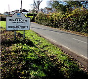
in ST1572, near Michaelston-le-Pit, taken Friday, 25 November, 2016, by Jaggery
Explore these images in the Browser or Explore matching images including in surrounding squares (if any!)
All images  © Jaggery and licensed for reuse under this Creative Commons Licence
Other Automatic clusters in ST1572
- St Michael All Angels Church
- Near Michaelston-le-Pit
- Penyturnpike Road North of Dinas Powys
- Ordnance Survey Cut Mark
- Fields Near
- Speed Limit
- Village Churchyard
- Public Footpath
- Postbox
- Boundary Sign
- Lychgate
- Lych Gate
- Farm Access Road
- Church in Wales Diocese of Llandaff
- Woodland